Jul 17 2008
THE REST OF THE RIVER
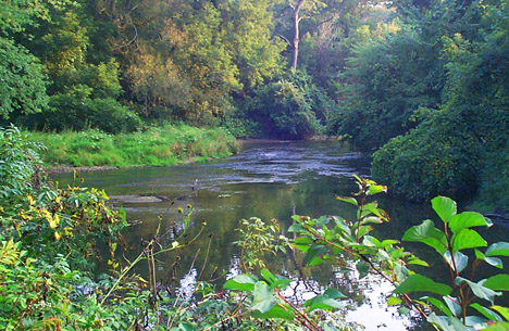
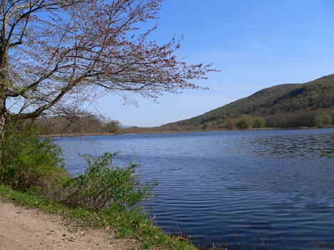
The EPA defines the Rest of the River as the portion of the Housatonic that flows from the confluence of the East and West branches down through Berkshire County into Connecticut and the Long Island Sound.
Under the terms of the Consent Decree, the EPA performed a series of studies in order to develop Human Health and Ecological Risk Assessments. It also performed a Modeling Study of the hydrodynamics, sediment transport, and PCB fate and bioaccumulation in the river. These studies underwent a formal Peer Review process.
The EPA summarized the rest of the process:
Following the RCRA process outlined in the Reissued RCRA Permit (Appendix G to the Consent Decree) GE prepared a Supplemental RCRA Facility Investigation Report, and proposed interim cleanup goals for the Rest of River upon completion of the risk assessment Peer Reviews. GE will submit a proposal for evaluating cleanup alternatives and, after EPA approval or modification of this proposal, GE will evaluate cleanup alternatives (corrective measures) for the Rest of River, including a no action scenario.
EPA will then propose a selected alternative for public comment. After public comment, EPA will finalize the corrective measure(s) to be implemented for the Rest of River. GE and/or the public may then appeal EPA’s decision to the EPA Environmental Appeals Board, and then to the Federal Court of Appeals. As specified in the Consent Decree, upon completion of all appeals, the remedy that was upheld will be implemented by GE as a CERCLA action.
A fact sheet prepared by EPA notes:
The Ecological Risk Assessment characterizes the risk posed to animals exposed to PCBs and other contaminants from the GE facility in Pittsfield, MA, while living and/or feeding in the river and floodplain …
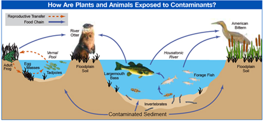
Animals are exposed to contaminants through breathing (inhalation); eating, drinking, or preening (ingestion); or by skin contact (dermal). The Exposure Assessment is an estimate of how specific animals may come into contact with chemicals and how often (for example, the number of fish a mink eats from the river). The most important exposure for many animals in the Rest of River is through their diet. A range of likely exposures was developed for representative species based on where they live and what they eat, to estimate the amount and types of contaminants they ingest over time …
The ERA evaluated the survival, growth, and reproductive success of the following species:
Fish
Insectivorous birds (tree swallows and American robins)
Piscivorous (fish-eating) birds (belted kingfisher and osprey)
Piscivorous mammals (mink and river otter)
Omnivorous and carnivorous mammals (northern short-tailed shrews and red fox)
Endangered species (American bittern, bald eagle, ands mall-footed myotis bat)In addition, the assessment evaluated the community condition, survival, reproduction, and development of:
Benthic invertebrates
Amphibians (leopard frogs and wood frogs)
EPA identified the following risks PCB-contamination poses to the species that live in and alongside the River:
Benthic Invertebrates
Benthic invertebrates, including insects such as dragonflies … that live on and in river sediment for part of their lives, were evaluated in this ERA because they form the base for the food chain in the river. Three different aspects of the benthic invertebrates in the river were evaluated: the community structure; site-specific toxicity studies (conducted both in the river and with river sediment in the laboratory); and a comparison of measured benthic tissue concentrations to sediment quality benchmarks from the literature. The risk characterization indicates that there is significant risk to aquatic invertebrates in the PSA, and that risk may also occur in limited areas downstream of Woods Pond to Rising Pond.
Amphibians
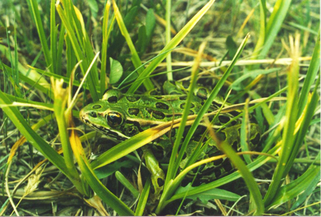
Amphibians were included in the ERA because they are known to be sensitive to PCBs and other contaminants, and there are 14 different species of frogs, salamanders and newts that live in contaminated water, sediment and soil in the Housatonic River and floodplain. Exposure and effects were evaluated using two site-specific studies that measured reproduction and development, and two field surveys that measured species richness, abundance and egg mass density. The risk characterization indicates that there is a high probability of ecologically significant risk to amphibians such as leopard frogs … above Woods Pond Dam. In addition, several large areas of the floodplain may pose risk to amphibians between Woods Pond and Rising Pond, with only small isolated areas of potential risk downstream of Rising Pond.
Fish
Fish were included in the ERA because they are known to be sensitive to PCBs and other contaminants, and historical information showed that fish in the Housatonic River contained very high concentrations of PCBs. Exposure and effects were evaluated using several methods, including the following: two site-specific toxicity tests (one using fish taken from the river, the other exposing hatchery fish to Housatonic River contaminants) that evaluated biological responses to contaminants; field surveys of habitat used by fish in the river and by nesting largemouth bass; and comparisons of site-specific fish tissue concentrations to effects levels gleaned from the literature. The risk characterization indicates that there is a high probability of moderate impacts to fish, such as largemouth bass. These impacts do not appear to be affecting the sustainability of the local fish populations in the PSA under current conditions (existence of fish advisory). No risks were indicated in any of the reaches below the PSA. However, coldwater species, such as trout, are potentially at risk in Reaches 7 and 9, but not farther downstream.
Several environmental groups submitted comments as part of the risk assessment process. Here is some of what Mass Audubon wrote:
Mass Audubon owns and operates the 262-acre Canoe Meadows Wildlife Sanctuary,
located in Pittsfield within reach 5A, not far downstream from the confluence of the East and
West branches. The sanctuary, which fronts the Housatonic River for approximately one-half
mile, is home to seven state-listed species of animals and plants, including American Bittern
(state endangered) and Wood Turtle (special concern). A considerable amount of the sanctuary’s acreage is within the 10-year floodplain directly affected by PCB contamination. The sanctuary, since its establishment in 1975, has been dedicated to natural resource conservation and education.As such, the negative impacts on wildlife as a result of PCB contamination weigh even more heavily upon the sanctuary than upon parcels dedicated to other uses. Canoe Meadows Wildlife Sanctuary is located in Reach 5A, the first section (most northerly) dealt with in this report. The highest concentrations and frequency of detections of PCBs are found in Reach 5.
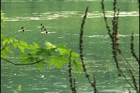
The predicted risks to amphibians is highest in Reach 5A; a majority of the amphibians and 50% of the vernal pools are at risk. Fish are at risk in all reaches of the Prime Study Area. Other wildlife species deemed to be at high risk include birds (Bald Eagle, Wood Duck, and Osprey) and mammals (Mink, River Otter, Short-tailed Shrew). Several other species were estimated to be at intermediate risk. The studied species are representative of many other species of wildlife present in the area, which are likely to be at risk from exposure to PCBs.
In June 2003 the EPA released a Fact Sheet for its Human Health Assessment. It states:
The Human Health Risk Assessment characterizes the cancer and noncancer risks to adults and children who are exposed to PCBs and other contaminants from the GE facility in Pittsfield, MA, while living or working near the Housatonic River, or using the river and floodplain for recreation or agricultural purposes.
The report evaluates three primary routes through which people may be exposed to PCBs and other contaminants that originated from the GE facility in Pittsfield, MA. These include:
• Direct contact with soil and sediment during recreational, residential, commercial and agricultural activities in the floodplain.
• Consumption of fish and waterfowl taken from the Housatonic River.
• Consumption of agricultural products produced in the floodplain such as milk, eggs and plants …
SUMMARY OF FINDINGS
• Potential risks from eating fish and waterfowl exceed the EPA risk range. These activities present a higher risk than direct contact or eating locally grown agricultural products.• In general, the risks are higher from fish or waterfowl taken closer to the site of the PCB releases, at the GE facility in Pittsfield, than those caught progressively farther downstream.
• For both fish and waterfowl consumption, the cancer risks from PCBs and TEQ greatly exceed EPA’s risk range in both Massachusetts and Connecticut.
• For both fish and waterfowl consumption, the noncancer risk greatly exceeds the EPA benchmark of an HI of 1.
• The HIs for locations in the Massachusetts portion of the study area are higher than those at the Connecticut locations.
• Although the amount of frogs and turtles consumed was assumed to be much less than fish and waterfowl, concentrations of contaminants in these species would also result in risk if consumed in large quantities.
HI = noncancer hazard indices. TEQ = toxic equivalence.